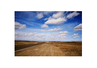
Northeast China Plain is the biggest plain
in China. It is situated in central Northeast China, with an area of about 350,000
square km. It is bordered by Changbai Mountains in the east, Xiaoxing'anling Mountains
in the north and Liaodong gulf in the south.
Northeast China Plain is in temperate and warm temperate zones, bearing the characteristics
of continental climate as well as monsoon climate. The summer there is short, warm,
and rainy, and the winter is long, cold with little snow. The monsoons change between
summer and winter.
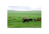
Northeast China Plain is famous for its black soil, which contains a lot of organic
substances. People describe it in such words as "the soil there is so fertile that
it oozes oil with just a nip; even a piece of firewood could bud when stuck in the
soil". Northeast China Plain is an important base for grain, soy bean and husbandry
in China. It also abounds in oil, coal and other mineral resources under ground.
It is the base for steel and iron, mechanics, energy resources and chemical engineering.
The famous Daqing Oilfield is located in the north of the plain.
Reference data
Northeast China Plain can be divided into three parts. The northeast part is Sanjiang
Plain formed by Heilongjiang River, Songhuajiang River and Ussouri Rivers alluvial
deposits. The north part is Songnen Plain formed by the alluviation of Songhuajiang
River and Nenjiang River and their tributaries. The south part is Liaohe Plain formed
by the alluviation of Liaohe River system.
Previous Next